All places
48 places found in South Zealand
Albuen
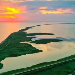
Albuen is a long, narrow and characteristically curved spit on the west coast of Lolland, enclosing Nakskov Fjord and stretching into the Langeland Belt. Albuen forms the outermost part of the 5 km long sand spit Dragene, which is between 20 and 200 metres wide, created by stones and sand carried here over thousands of years. The area lies within Naturpark Nakskov Fjord and offers sweeping views, an open, wind-swept landscape and a particularly beautiful light. Albuen also holds a surprising cultural history: from the 15th century until well into the 20th century, Albuen Harbour was a significant fishing port with lively trade, particularly during herring seasons. A lighthouse still stands, and the former pilot station now serves as a museum and nature centre. Vegetation is sparse and there is little shelter from the wind, but the area has a rich birdlife and parts of it are a protected bird reserve. Spring and autumn are especially rewarding for birdwatching. The area is well suited to walking and cycling, and coastal fishing, kayaking and surfing are also possible. Near the village of Ydø there is a campsite from which walks can begin, or cars can be parked at Rampen. Bring plenty of water and food, as there are no facilities along the way, and remember wind-proof clothing. Dogs off leads are prohibited to protect the birdlife.
📍 Albuen, 4900 Nakskov
Avnø Naturcenter
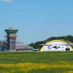
Avnø is a magnificent nature area northwest of Vordingborg, where the peninsula was previously both an island and a military airbase. The airbase was decommissioned in 1993, and since 2004 the site has functioned as a nature centre. The open landscape with coastal meadows, a lake and some woodland is home to a rich birdlife — waders, geese, ducks and birds of prey — and harbour seals live in the fjord year-round. Avnø Nature Centre is unstaffed and open around the clock; the former airbase buildings house an exhibition, and from the old control tower there is a panoramic view across the entire area. There are marked circular routes of around 3 km, a fire shelter and benches along the coast. The nature centre is run in collaboration between Vordingborg Municipality, Næstved Municipality and the Danish Nature Agency.
📍 Flyvervej 40, 4750 Lundby
Basnæs Havn
Basnæs Harbour is a small fishing settlement on Dybsø Fjord on the south Zealand coast between Næstved and Vordingborg. The harbour lies on the edge of the Basnæs estate, facing the shallow fjord — one of Denmark's cleanest — which is home to rich birdlife and wildlife. Here you can see the characteristic flat-bottomed fishing boats and experience the quiet of a harbour still used for fishing. The area around Dybsø Fjord is part of a larger natural landscape of coastal meadows and reed beds that attracts migratory birds in spring and autumn — bring binoculars for a good chance of spotting herons and waders. The harbour is reached via Dybsøvej.
📍 Dybsøvej, 4700 Næstved
Bogø
Bogø is a small island with a charming village, harbour and views over the Grønsund strait. Perfect for cycling and a peaceful day close to nature.
📍 Bogø, 4793 Bogø By, Danmark
Bøndernes Egehoved
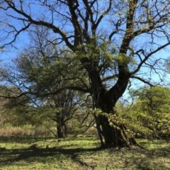
Bøndernes Egehoved is a small, protected nature area on the Jungshoved peninsula near Roneklint, facing Præstø Fjord. The site has been called the epitome of Danish nature romanticism — a park-like Golden Age landscape where beech trees mirror their crowns in the fjord, and where Achton Friis, in his 1930s work "De Danskes Land", praised the wide view over the water. Behind the idyll lies an unusually rich nature: the area contains the three threatened habitat types — grassland, fen and coastal meadow — and oak trees more than 400 years old provide habitat for a wide range of species. Rare plants grow here among tussocks of yellow meadow ants, and old thickets of hornbeam, crab apple, hawthorn, wild roses and field maple can be found. The area is known for its tree frogs, rare fungi and rich birdlife, and continued grazing helps the species-rich flora thrive. The site was long difficult to access due to overgrowth, but a local nature project on Jungshoved has laid out paths so visitors can once again experience the atmospheric landscape — a perfect spot for a woodland walk or a summer picnic.
📍 Roneklintvej 5, 4720 Præstø
Bøndersvig Enge
Bøndersvig Enge lies on the shore of Søndersø below the golf course, as part of Naturpark Maribosøerne. The low, damp meadows facing the lake are a fine place to experience the nature park's rich birdlife, and the area is often highlighted as a good spot for seeing white-tailed eagles — visitors who remember to look up have a good chance of spotting one at Maribosøerne. The meadows are a calm, undisturbed natural area close to Maribo, well suited for a walk where you can enjoy the view over the lake and scan for waders and waterfowl with binoculars. Together with the nature park's other paths and lakeshores, Bøndersvig Enge forms part of one of Denmark's most significant inland nature areas.
📍 Søndersøvej, 4930 Maribo
Bøtø Nor Fuglereservat
Bøtø Nor is a 175-hectare bird and nature reserve on the southern tip of Falster, established as compensation for the large-scale drainage of the original 2,245-hectare lagoon, which was converted to agricultural land from 1860 onwards. The reserve's central lake, surrounded by meadows, reed beds and seasonally flooded areas, supports an exceptionally rich birdlife: breeding cranes, marsh harriers, teal, garganey and spoonbills nest here in summer, while winter brings large flocks of barnacle geese, bean geese and whooper swans. Three observation towers allow visitors to observe birds at close range — access inside the reserve itself is prohibited year-round. In recent years, the Danish Nature Fund and Guldborgsund Municipality have acquired adjacent land and periodically flooded it, attracting rare waders such as wood sandpiper and ruff in large numbers.
📍 Bøtøvej, 4873 Væggerløse
Brøndehøje Skanse
At the top of the coastal escarpment at the western end of the forest Busene Have, on the south-eastern tip of Møn about four kilometres east of Klintholm Harbour, lies Brøndehøje Skanse. The fortification was built during the Swedish Wars of 1658–60 and is said to have had six cannons, though it is widely believed the site has roots stretching back to the Middle Ages, when small defensive works were erected along exposed coasts to guard against raids from the Baltic. From the redoubt there is a wide view over the Baltic Sea, from where approaching enemy ships could be signalled in good time to the other coastal defences and to the towns inland. The site also bears traces of a vanished fishing village: near the redoubt lay Brøndhøje, which during the height of the herring fishery was closely connected to the Lübeck merchants' Baltic trade and brought great prosperity to Møn, until the settlement was washed away in the storm surge of 1625 and never rebuilt. The redoubt is part of one of Denmark's richest prehistoric landscapes: the surrounding Busene Have contains a long barrow and ten round burial mounds, presumably from the Bronze Age, and visitors are quickly captivated by the special atmosphere where history and nature are closely intertwined.
📍 Hampelandsvej, Busene Have, 4791 Borre
Dark Sky Park Møn og Nyord
In 2017, Møn and Nyord became the first places in the Nordic region to be certified as an International Dark Sky Park and International Dark Sky Community by the international organisation DarkSky International (IDA) — and uniquely in world history, they received both certifications at once. This followed a dedicated local effort that has worked since 2014 to reduce light pollution and preserve darkness as a resource for nature, wildlife and people. Møn and Nyord are Denmark's darkest place and among the darkest measured locations in Europe: on clear, moonless nights the Milky Way can be seen with the naked eye, and there are good opportunities to observe planets, nebulae and meteors. The area offers organised night walks, stargazing and events tailored to the night sky — visitors are advised to plan their visit during periods of new moon and clear skies for the best experience.
📍 Høje Møn, 4791 Borre, Danmark

Dybsø Fjord
Dybsø Fjord is a shallow inlet on the south-western Zealand double coastline, between Næstved and Vordingborg. The fjord covers around 17 square kilometres and has an average depth of barely one metre. To the west it is separated from Karrebæksminde Bay and the Småland Waters by the low barrier island of Dybsø and the southern tip of Enø, while the Svinø peninsula lies to the south. The fjord is considered one of Denmark's cleanest, and its low salinity and lush, sandy bottom make it a particularly rich natural area.
📍 Dybsø Fjord, 4736 Karrebæksminde
Enehøje
Enehøje is an island of just under 1 km² in the outer part of Nakskov Fjord, reached by the mail boat Vesta from Nakskov Harbour. The island has been inhabited since the 1500s and still had 25 permanent residents in 1925 — today it is uninhabited. From 1926 to 1940 the island was owned by the colourful polar explorer, author and journalist Peter Freuchen (1886–1957), who retreated here from the world to write; he received well-known guests in his blue summer house, which can still be seen. Freuchen is best known for the Thule Expedition with Knud Rasmussen and for a long series of books and films about the Arctic, and he has since become one of the most legendary figures in Danish polar history. A trip to Enehøje is a journey to a place that holds both nature and a surprising biographical connection.
📍 Enehøje, 4900 Nakskov, Danmark
Fanefjord Skov
Fanefjord Skov stretches along the western side of Møn down towards Fanefjord and is a peaceful state-owned forest area with trails, deciduous woodland and viewpoints over the fjord. The forest is well suited for walks and family outings, and the forest floor's flowering plants change with the seasons. From the forest it is a short distance to Fanefjord Church — one of Møn's oldest churches, with medieval frescoes — and to Grønjægers Høj, one of Denmark's most impressive long barrows. The nearby campsite offers the option to stay overnight amid natural surroundings. The forest is managed by the Danish Nature Agency.
📍 Fanefjord Skov, 4792 Askeby, Danmark
Fårebakkerne
Fårebakkerne is a protected hill landscape on the Mogenstrup ridge near Næstved, formed during the last Ice Age. The hills rise to around 55 metres above sea level, among the highest points in southern Zealand. A viewing bench has been placed at the top, offering fine views over the surrounding landscape. The area is used for walking and dog walking — and for sledging in winter.
📍 Fårebakkerne, Næstelsø, 4700 Næstved
Farø
Farø is a small island in Storstrømmen with only five permanent residents, which in 1985 became the focal point of the two Farø Bridges — the motorway bridges connecting Zealand with Falster. Today the island is bisected by the motorway, but on either side there are walking trails and open coastal landscape. The Sjællandsleden hiking route passes by the island. The area around the bridges is popular with kitesurfers, and kayaking around Farø and Bogø offers close contact with the windswept waters of Storstrømmen.
📍 Farø, 4793 Bogø By, Danmark
Fejø Økologiske Madskov
Fejø Organic Food Forest is a pioneering project in permaculture and regenerative agriculture on the island of Fejø in the Smålandshav. The 3,000 m² site hosts over 300 different edible plant species and serves as a living demonstration of forest gardening — working with nature rather than against it. The project has been certified as a Slow Food Farm, among the first in Denmark. Visitors can harvest fresh produce with guidance, taking food directly from soil to table, and participate in guided tours and workshops. The season runs from May to September, with visits primarily by appointment.
📍 Storemosevej 75, 4944 Fejø
Femø og Fejø (ø-hop)
Fejø and Femø are reached by ferry from Kragenæs on Lolland and offer two different experiences of quiet island life in the Smålandsfarvandet strait. Fejø is best known for its orchards — especially the apple and cherry growing that the island's farms have practised for generations — and the Fejø apple's reputation as one of Denmark's finest apple varieties has given the island an identity reaching far beyond Lolland. The island offers cycling routes through the orchards, coastal meadows and a relaxed atmosphere. Femø is even more remote and unspoilt: a small harbour, an authentic island environment and undisturbed nature. Both islands are well suited for a day trip and can also be combined into an island-hopping tour — it's worth planning a visit during the harvest season, when the orchards are at their most beautiful.
📍 Fejø/Femø, 4944 Fejø/4945 Femø, Danmark
Gavnø Slotspark og skov
The castle park at Gavnø Castle is a historic park of approximately 80,000 m² in scenic surroundings on the island of Gavnø south-west of Næstved. The park is best known for Denmark's largest and oldest tulip festival, founded in 1957, which transforms the flowerbeds into a sea of colour with thousands of tulips in changing patterns every spring — the castle gardeners plant new bulbs each autumn, so no two seasons are alike. The park offers beautiful flowers throughout the season and includes a rose garden with a rose maze, a sensory garden and a Sakura cherry blossom avenue with around 40 trees over 100 years old in the northern part. There is plenty of space for walks and nature experiences for the whole family, and the park also serves as the venue for several of Gavnø's events.
📍 Gavnø 2, 4700 Næstved, Danmark
Gedser Odde
Gedser Odde is Denmark's southernmost point — a headland on the southern tip of Falster that juts into the Baltic Sea at coordinates 54° 33′ N, 11° 58′ E. The former naval station at the tip now houses an exhibition and community centre telling the story of the headland's nature, geology, birdlife and its strategic role during the Cold War, when the station monitored Warsaw Pact shipping traffic towards the Øresund. In the atrium garden stands the four-tonne Sydstenen (Southern Stone) as a symbol of Denmark's southernmost point. Gedser Odde is one of the country's most important migratory bird sites: Falster acts as a funnel channelling tens of thousands of birds out over the sea every spring and autumn. Gedser Bird Station, run by volunteers from the Danish Ornithological Society in the former lighthouse keeper's residence, rings more small birds than anywhere else in Denmark — up to 16,000 in autumn. Gedser Lighthouse, inaugurated in 1802 and most recently renovated in 2021, can be seen 48 km away.
📍 Gedser Odde, 4874 Gedser
Gisselfeld Kloster Skovruter
Gisselfeld Kloster Skovruter is a network of walking routes in and around the forests of Gisselfeld Kloster near Haslev. The routes pass through varied terrain with lakes, hills and historic tree-lined avenues. The forests are freely accessible and form a significant natural area in South Zealand.
📍 Gisselfeldvej 3, 4690 Haslev, Danmark
Hesede Skov
Hesede Skov is a large, privately owned forest of around 424 hectares, located between Haslev and Næstved in southern Zealand. The forest belongs to the Gisselfeld estate and consists mainly of deciduous woodland with oak and beech, along with scattered conifer plantations. The terrain is markedly hilly, with sandy moraine hills from the Ice Age, and in the south the landscape reaches around 100 metres in height. Many of the forest's dead-ice depressions have over time been turned into carp ponds, and the forest holds both geological and cultural-historical traces.
📍 Villa Gallinavej 3, 4690 Haslev
Historisk Botanisk Have
The Historisk Botanisk Have in Vordingborg was laid out in 1921 by landscape architect G.N. Brandt and was the first of its kind in Denmark. Situated alongside the historic Vordingborg Castle ruins, the garden presents historical cultivated plants and garden traditions in authentic castle surroundings. Entry is free and the garden is open every day of the year.
📍 Slotsruinen 1 , 4760 Vordingborg
Horreby Lyng
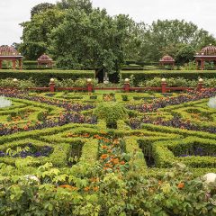
At approximately 150 hectares, Horreby Lyng is the largest raised bog in Guldborgsund Municipality and one of the largest remaining raised bogs in eastern Denmark. The bog is designated as a Natura 2000 site and has been protected since 1981, built up from peat mosses with rare raised bog flora: royal fern, bell heather, bog rosemary, cranberry and the insect-eating round-leaved sundew grow here, and 11 bat species have been recorded in the area. During the First and Second World Wars the bog was heavily exploited for peat cutting — Nykøbing F's sugar factory extracted up to 6,000 tonnes of peat per year. An EU LIFE-funded nature restoration project from 2013–21 has closed drainage ditches and restored the bog's water level. Today there are wooden walkways over the wettest sections, a nature room with an exhibition about the project's results and the bog's cultural history, and a viewing platform — on the drier edges you may encounter common adders.
📍 Horreby, 4871 Horbelev
Høvblege
Høvblege is a remarkable nature area on eastern Møn near the village of Mandemarke, situated on chalk bedrock close to Møns Klint. The open chalk grassland is home to an unusual abundance of rare plants, including wild orchids, and harbours the rare butterfly sortplettet blåfugl (Maculinea arion). The area offers spectacular sea views. Høvblege is a tranquil and botanically valuable nature site, easy to combine with a visit to Møns Klint.
📍 Mandemarke, 4791 Borre
Jarsskov
Jarsskov is a peninsula extending into Dybsø Fjord, south of Vester Egesborg in South Zealand. The forest combines coastal meadows, reed beds and mixed woodland within the protected coastal landscape of the shallow fjord. Two bird-watching towers overlook the fjord and adjacent meadows — one on the eastern forest edge, one facing west. From the car park at the entrance, forest tracks lead on foot to the peninsula's southern tip and to the tower by the shore. The area is one of South Zealand's prime birdwatching sites.
📍 Jarsskov, 4700 Næstved
Jungshoved Nor
Jungshoved Nor is a shallow, enclosed fjord landscape south-east of Præstø, formed at the end of a tunnel valley system from the last ice age. The coastal areas feature salt meadows and marsh with a rich flora; small centaury, which has only two localities in Denmark, and the rare brackish-water plant large naiad have been recorded here. The marsh harrier breeds in the reed beds. The 1976 nature protection order covers 449 hectares and forms part of the Ulvshale-Nyord wildlife reserve and EU bird protection area. The nor is best experienced from Jungshoved Kirke and the castle mound, or from the water in a flat-bottomed boat or kayak.
📍 Jungshoved, 4720 Præstø
Kalbyrisskoven
Kalbyrisskoven is an urban forest in the eastern part of Næstved. The forest is owned by Herlufsholm School and Estate and is one of the forests that many Næstved residents use for nature experiences close to the city. Kalbyrisskoven is a beautiful, open deciduous forest that is particularly varied — here you find many of the native deciduous tree species in an age- and species-diverse mixed forest, which is quite unusual.
📍 Kalbyrisvej 185, 4700 Næstved
Kalvehave Havn
Kalvehave Harbour is a charming marina on the Ulvsund strait, situated directly beneath the Queen Alexandrine Bridge — Mønbroen — connecting South Zealand with Møn. During summer months the old ferry 'Møn' runs as a 'sailing cycle path' between Kalvehave and Stege Harbour. The harbour is a starting point for kayaking, snorkelling on the underwater trail and day trips to Møn, with a café and the cultural venue Den Gule Stald close by.
📍 Kalvehave Havnevej 62, 4771 Kalvehave
Klinteskov (Møn – Sydsjælland region)
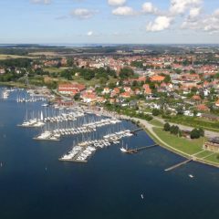
Klinteskov is a state forest along Møns Klint featuring old beech trees, dramatic chalk cliffs and views over the Baltic Sea. The forest forms the hinterland of Møns Klint and contains walking trails connecting the cliff with GeoCenter Møns Klint. Free access year-round.
📍 Stengårdsvej, 4791 Borre, Danmark
Knudshoved Odde Vandrerute
Knudshoved Odde is a narrow peninsula near Vordingborg with sea on both sides and an extended walking route. The terrain is flat and supports abundant birdlife and an undisturbed coastal landscape. The peninsula is a popular destination for birdwatchers. See udinaturen.dk for route information.
📍 Knudshoved Odde, 4760 Vordingborg, Danmark
Knudsskov (ved Knudshoved Odde)
Knudsskov on Knudshoved Odde near Vordingborg is a low-growing coastal woodland and scrub landscape with open areas and views over the water. The forest forms part of the nature-rich coastal area on the inner side of the peninsula and is included in the Knudshoved Odde route. See udinaturen.dk for route information.
📍 Knudsskovvej, 4760 Vordingborg, Danmark
Knuthenborg Safaripark
A few kilometres north of Maribo, near Bandholm on Lolland, lies Knuthenborg Safari Park — Northern Europe's largest safari park and one of Denmark's most visited tourist attractions. The park grounds that guests drive through were laid out in the 1860s as the estate's grand garden with rare plants from around the world, surrounded by a characteristic granite wall, and even then visitors could pay to enter. In the 1950s a deer park with sika deer was added, and in 1969 Count Adam Knuth transformed the site into a full safari park — with the then completely new idea that guests could drive through nature in their own car and discover the animals up close. Today the park houses more than 1,000 free-roaming animals across around 70 species, including Siberian tigers, giraffes, rhinoceroses and elephants, divided by the continents they come from. Visitors can drive, cycle or walk among the old trees, historic buildings and animals, and many of the species are endangered and participate in international breeding programmes. In 2018 the Dinosaur Forest opened, and an evolution museum tells the story of life's development. With a nature playground, accommodation with views of the animals and visitor numbers reaching 410,000 in the record year 2020, Knuthenborg is an ideal full-day destination for families.
📍 Knuthenborg Parkvej 1, 4930 Maribo, Danmark
Mallings Kløft
Mallings Kløft near Stensbygård, south of Stensved, is a scenic and peaceful natural area in South Zealand. The valley floor was once home to five water mills, and the stone foundations of several old mills can still be seen along the stream. A path follows the stream through the entire gorge and emerges onto open farmland with a beautiful view of the Storstrøm strait and the Farø bridges. The site can be tricky to find: take Vestenbækvej, turn onto Stensbyvej, and look for the gorge on the left side of the road at a sharp bend. Parking on the opposite side.
📍 Mallings Kløft, 4772 Langebæk
Maribo Søerne
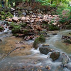
Maribosøerne is a nature area near Maribo on Lolland comprising a series of lakes surrounded by forests and meadows. The area is designated as a nature park and supports rich birdlife as well as walking and cycling routes. See naturparkmaribosoeerne.dk for maps and route information.
📍 Refshalevej 69, 4930 Maribo, Danmark
Maribosøerne Vandreruter
Maribosøerne Vandreruter is a network of walking paths around the lakes near Maribo on Lolland. The routes pass through varied nature with woodland, lakeshores and birdlife, and are suited to both short and longer walks. See naturparkmaribosoeerne.dk for route maps and information.
📍 Bangshavevej, 4930 Maribo, Danmark
Masnedø
Masnedø is a small island near Vordingborg, connected to Zealand and Falster via the Storstrøm Bridge road. The island has green areas, a harbour and views of the new Storstrøm Bridge under construction. Masnedø Fort, an old coastal fortification, is open to the public and is also used for festivals and cultural events.
📍 Masnedø, 4760 Vordingborg, Danmark
Møns Klint
Møns Klint is one of Denmark's most spectacular natural areas, with chalk cliffs up to 128 metres high rising vertically from the sea. The area offers hiking routes, viewpoints and the opportunity to find fossils.
📍 Stengårdsvej 8, 4791 Borre, Danmark
Møns Klint Vandreruter
The walking routes at Møns Klint run along the white chalk cliffs with views over the Baltic Sea. Several routes pass through Klinteskoven and down to the beach. See moensklint.dk for route maps and information on difficulty and access.
📍 Stengårdsvej 8, 4791 Borre, Danmark
Naturlejrplads Boesdal Kalkbrud
Naturlejrplads Boesdal Kalkbrud is a primitive shelter site in the disused Boesdal lime quarry south of Stevns Klint, between Lille Heddinge and Rødvig. The site is established and operated by Stevns Municipality and consists of two shelters and a composting toilet that can be used freely. Tent pitching in connection with the shelters is also possible. The site lies within the quarry itself, which was in operation from 1914 to 1978 and is now part of the UNESCO World Heritage area surrounding Stevns Klint. From the camp site there is a short walk to both the trail along Stevns Klint, the characteristic pyramid-shaped storage building from 1967 and the two preserved lime kilns from 1930. Access to the beach is from the quarry without steps. The camp site has no drinking water — the nearest tap is at the car park on Boesdalsvej. The shelters can be used freely or booked in advance via friluftsguiden.dk. Access via Boesdalsvej, 4673 Rødvig Stevns.
📍 Boesdalsvej, 4673 Rødvig Stevns
Naturpark Maribosøerne
Naturpark Maribosøerne is a designated nature park near Maribo on Lolland, comprising a series of lakes surrounded by forests and meadows. The park features walking and cycling routes, shelter and camping sites, and rich birdlife. See naturparkmaribosoeerne.dk for maps, activities and information.
📍 Bangshavevej, 4930 Maribo, Danmark
Nyord
Nyord is a small island north of Møn, connected via a narrow bridge. The island holds two very different worlds: to the north, the vast Nyord Enge — one of eastern Denmark's most important bird protection areas, home to barnacle geese, white-tailed eagles and black-tailed godwits — and to the south, the well-preserved historic village, whose half-timbered farmhouses and pilot tradition have kept Nyord almost unchanged since the 1800s. Nyord is also part of Dark Sky Park Møn og Nyord, which in 2017 became the first in the Nordic countries to receive international Dark Sky Park certification, and on clear nights the island is one of the darkest places in Denmark. Visitors are encouraged to park by the bridge and walk — driving in the village is discouraged — and the island is best suited to quiet visits, walks and birdwatching.
📍 Nyord, 4780 Stege, Danmark
Nyord Enge
Nyord Enge covers around 400 hectares on the northern part of the island of Nyord and is one of the most important bird protection areas in eastern Denmark. Since 1971, the Danish bird conservation fund Fugleværnsfonden has gradually acquired the meadow areas to preserve them as habitat for geese, ducks and waders, and today the meadows are a destination for bird enthusiasts from all over the country. From the recently renovated bird tower — refurbished in autumn 2021 with wheelchair access — there are views over the meadows and the flocks of barnacle geese, which can number 5,000-7,000 individuals during migration. Nyord Enge is one of the last places in eastern Denmark with breeding black-tailed godwits, and in winter an unusually large number of white-tailed eagles regularly rest in the meadows. Peregrine falcons are seen in the area year-round.
📍 Nyord, 4780 Stege, Danmark
Nyord Enge Naturreservat
Nyord Enge is an extensive nature reserve on the small island of Nyord north of Møn. Around 400 hectares of coastal meadows, reed marshes and shallow inlets attract a rich birdlife – especially waders, ducks and geese during migration. Nyord is connected to Møn by a narrow bridge and offers an unusual tranquillity and unspoilt nature close to civilisation. The coordinates indicate the starting point of the reserve at Ulvshalevej.
📍 Ulvshalevej 401, 4780 Stege
Orehæld Strand
Orehæld Strand is a small, peaceful natural area on western Møn with views across the water towards the fishing hamlet of Petersværft on the South Zealand coast. A quiet spot for a short walk or a stop with views over Storstrømmen.
📍 Orehæld, 4780 Stege
Præstø Fed skovområde
Præstø Fed is a nature and woodland area on the Præstø Fed peninsula with a sandy beach, coastal meadows and woodland stretches along Præstø Fjord. The area is suited to walks by the water. See Vordingborg Municipality's outdoor recreation information for access details.
📍 Fed Strand, 4720 Præstø, Danmark
Præstø Fjord Sti
Præstø Fjord Sti is a route along Præstø Fjord with views over the water, coastal meadows and birdlife. The route is suited for walking and cycling. See vordingborg.dk for route information and access details.
📍 Præstø, 4720 Præstø, Danmark
Sakskøbing Fjord og Natur
The area around Sakskøbing Fjord in southern Lolland is characterised by shallow fjord flats, reed beds and birdlife. Walking and cycling routes run along the coast. Naturstyrelsen's website naturstyrelsen.dk contains maps and information about recreational opportunities in the area.
📍 Sakskøbing Fjord, 4990 Sakskøbing, Danmark
Stevns Klint
Stevns Klint is an approximately 15–17 km long coastal cliff on eastern Stevns, stretching between Rødvig in the south and Bøgeskov Havn in the north. The cliff rises to around 40 metres high and is built up of layers of chalk, white-grey bryozoan limestone and flint deposited over millions of years. Between the limestone layers lies the famous 'fish clay' — a thin sediment layer that marks the boundary between the Cretaceous and Palaeogene periods. Here researchers found an unusually high concentration of the element iridium, which became one of the key pieces of evidence that an asteroid struck Earth approximately 66 million years ago and triggered the mass extinction that wiped out the dinosaurs, among others. Due to this extraordinary geological significance, Stevns Klint was inscribed on UNESCO's World Heritage List in 2014. The area can be explored along Trampestien, which follows the coast the full length of the cliff, and at Højerup Gamle Kirke as well as the visitor centre Stevns Klint Experience in Boesdal Kalkbrud. Please note that it is not permitted to chip at the cliff or collect material from the layers.
📍 Klintevej 14, 4673 Rødvig Stevns
Vålse Vesterskov
Vålse Vesterskov lies in the northwestern-most corner of Falster facing the Småland Sea and belongs to Orenæs Estate. The mixed deciduous forest with adjoining coastal meadows offers rich birdlife, spring-flowering anemones and violets, and a tranquil natural area where you mostly hear nature's own sounds. In the forest lie the two megalithic graves Store and Lille Bondekirke from the Stone Age, and the site is associated with the legend of Horsjageren ("the Horse Hunter") — an eerie figure said by tradition to haunt precisely these dolmens. The forest is privately owned, but access is possible via paths and roads, and a roughly 5.5 km hiking route leads through the forest and along the beach.
📍 Vålse Vesterskovvej, 4840 Nørre Alslev